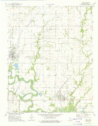
1973 Map of Erie
USGS Topo · Published 1975About this map
Erie and St Paul anchor this Neosho County landscape during the early 1970s, where the winding Neosho River and its various tributaries, such as Fourmile Creek and Flat Rock Creek, dictate the geography. The region's dual reliance on rail and natural resources is evident through the tracks of the Missouri - Kansas - Texas and Atchison Topeka and Santa Fe railroads, which cross the terrain alongside active extraction sites. Extensive energy development is concentrated in the Walnut Grove Oil Field, Erie Oil Field, and Mission Oil Field, marked by numerous oil and gas wells. Toward the southeast, the Neosho State Waterfowl Management Area preserves the river bottomlands near several local landmarks, including St Francis Cem and Hope Cem. This survey illustrates a Kansas river valley where industrial oil production and traditional agriculture coexist within the floodplain.
Find a feature on this map
28 named features on this map. Tap any name to fly to it.
Don’t see what you’re looking for? This feature index may not catch every label — zoom into the map to look around manually.
Map Details
Editions of this 1973 Erie Map
This is the sole edition of this map. No revisions or reprints were ever made.
Other maps of this area

1886 · Iola
USGS Topo · 1:125,000

1886 · Parsons
USGS Topo · 1:125,000

1893 · Iola
USGS Topo · 1:125,000

1893 · Parsons
USGS Topo · 1:125,000

1904 · Iola
USGS Topo · 1:125,000

1943 · McCune
USGS Topo · 1:62,500

1945 · Mc Cune
USGS Topo · 1:62,500

1945 · Parsons
USGS Topo · 1:62,500

1946 · Parsons
USGS Topo · 1:62,500

1947 · Parsons
USGS Topo · 1:62,500