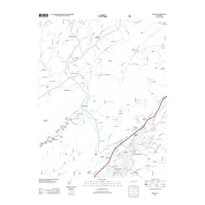
2013 Map of Erwin
USGS Topo · Published 2013About this map
The Nolichucky River carves a deep path through the Unicoi County landscape, anchoring a network of small settlements and rugged mountain hollows in the early 21st century. The city of Erwin serves as the primary hub, surrounded by residential areas like Banner Hill and Lillydale. Along the river's banks, historical crossing points and natural features such as Henleys Ford and Bayles First Shoals remain documented alongside the riverside community of Embreeville. To the west, the complex topography of Bumpus Cove is etched with numerous named hollows, including Starnes Hollow, Sugar Hollow, and Oak Hollow, hinting at a history of land use and small-scale habitation. The northeastern reaches of the map show the transition from the river valley to the heights of Buffalo Mountain, with the rural communities of Big Cherokee and Little Cherokee settled along their namesake creeks.
Find a feature on this map
184 named features on this map. Tap any name to fly to it.
Don’t see what you’re looking for? This feature index may not catch every label — zoom into the map to look around manually.
Map Details
Editions of this 2013 Erwin Map
This is the sole edition of this map. No revisions or reprints were ever made.
Other maps of this area

1891 · Roan Mountain
USGS Topo · 1:125,000

1892 · Greeneville
USGS Topo · 1:125,000

1894 · Roan Mountain
USGS Topo · 1:125,000

1896 · Greeneville
USGS Topo · 1:125,000

1904 · Roan Mountain
USGS Topo · 1:125,000

1904 · Greeneville
USGS Topo · 1:125,000

1935 · Chestoa
USGS Topo · 1:24,000

1935 · Leesburg
USGS Topo · 1:24,000

1935 · Erwin
USGS Topo · 1:24,000

1935 · Huntdale
USGS Topo · 1:24,000