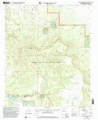
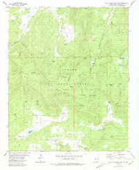
1999 Map of Escondido Mountain
USGS Topo · Published 2002About this map
Escondido Mountain and the surrounding highlands of the Apache National Forest define this landscape in Catron County, New Mexico. The area is characterized by a sophisticated water management system for ranching and forest service needs, evidenced by numerous named improvements such as Fish Pond Tank, High Rim Tank, and the Slaughter Tank. The southern portion of the quadrangle shows localized development near the water, including the settlement of El Caso and recreation-oriented spots like Quemado Lake. Terrain features like Cañon del Leon and Paradise Canyon cut through the high country, while the presence of the Escondido Trail and various pipelines suggest a landscape utilized for both utility and access. Natural water sources like Leyba Spring and El Caso Spring provided critical anchors for activity in this arid environment before the turn of the twenty-first century.
Find a feature on this map
40 named features on this map. Tap any name to fly to it.
Don’t see what you’re looking for? This feature index may not catch every label — zoom into the map to look around manually.
Map Details
Editions of this 1999 Escondido Mountain Map
This is the sole edition of this map. No revisions or reprints were ever made.
Other maps of this area

1954 · Saint Johns
USGS Topo · 1:250,000

1957 · Saint Johns
USGS Topo · 1:250,000

1958 · Saint Johns
USGS Topo · 1:250,000

1962 · Saint Johns
USGS Topo · 1:250,000

1967 · Omega
USGS Topo · 1:24,000

1967 · Quemado
USGS Topo · 1:24,000
1972 · Armstrong Canyon
USGS Topo · 1:24,000
1981 · Mangas Mountain
USGS Topo · 1:24,000
1981 · Largo Mesa
USGS Topo · 1:24,000
1981 · Gallo Mountains East
USGS Topo · 1:24,000