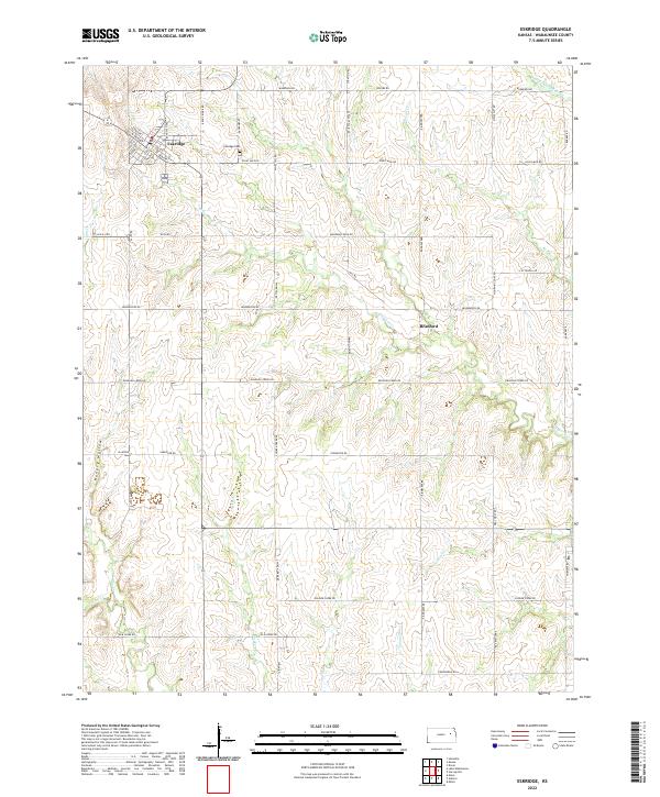
2022 Map of Eskridge
USGS Topo · Published 2022About this map
Eskridge serves as the primary hub of this eastern Kansas landscape, situated near the headwaters of several key drainage systems. The town's grid is well-defined by streets such as Bellevue Ave and S Walnut St, with the nearby Eskridge Cem providing a central point for local genealogical interest. The surrounding terrain is deeply carved by a network of waterways, including the S Br Wakarusa River to the north and the winding Dragoon Cr which flows toward the east. This section of Wabaunsee County is characterized by its agricultural layout, punctuated by distinctive natural features like Hungry Hollow and a series of named creeks including Chicken Cr and Soldier Cr. The small community of Bradford sits further east, connected by a network of rural roads such as Mourning Dove Rd and Headwaters Rd that follow the region's undulating topography.
Find a feature on this map
57 named features on this map. Tap any name to fly to it.
Don’t see what you’re looking for? This feature index may not catch every label — zoom into the map to look around manually.
Map Details
Editions of this 2022 Eskridge Map
This is the sole edition of this map. No revisions or reprints were ever made.
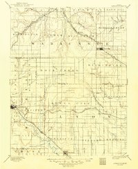
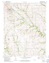
Historical Maps of Eskridge Through Time
5 maps found