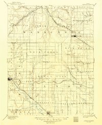
1889 Map of Eskridge
USGS Topo · Published 1889About this map
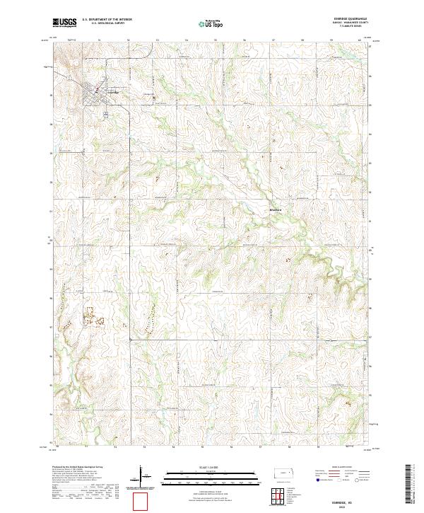
Council Grove and Eskridge anchor this late-nineteenth-century landscape, which is defined by a dense network of competing rail lines and sprawling prairie watersheds. The Atchison Topeka and Santa Fe Railroad and the Chicago Kansas and Nebraska Railroad cut across the northern terrain, while the Council Grove Osage City and Ottawa Railroad services smaller outposts like Admire City. This era shows Kansas in a state of rapid transit expansion, where even minor settlements like Bismark were connected to major trade routes. The topography is dominated by the intricate drainage of One Hundred and Forty Two Mile Creek and Dragoon Creek, illustrating the natural obstacles overcome by the surveyors as they mapped the developing townships of Wabaunsee and Lyon counties.
Find a feature on this map
66 named features on this map. Tap any name to fly to it.
Don’t see what you’re looking for? This feature index may not catch every label — zoom into the map to look around manually.
Map Details
Editions of this 1889 Eskridge Map
This is the sole edition of this map. No revisions or reprints were ever made.
Historical Maps of Council Grove Through Time
9 maps found