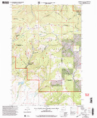
2001 Map of Esmeralda Hill
USGS Topo · Published 2004About this map
The Continental Divide winds across this high-elevation terrain in the Helena National Forest, marking the watershed between the Atlantic and Pacific oceans. This 2001 revision, based on earlier surveys and mid-century topography, reveals a landscape defined by an intensive history of mineral exploration along the Lewis and Clark and Powell County border. Dozens of mining features, including a Mine Shaft, an Adit, and numerous Prospects, are concentrated near peaks like Meyers Hill and Esmeralda Hill. This density of extraction sites suggests the area's significance to local prospectors through the twentieth century. Water is a vital component of the landscape, with reliable points like Pauly Springs, Lois Lake, and Dana Spring situated among a network of drainages including Snowshoe Creek and Deadwood Creek. The presence of the Betor Ranch highlights the few pockets of human settlement in this high-altitude mining and timber country.
Find a feature on this map
50 named features on this map. Tap any name to fly to it.
Don’t see what you’re looking for? This feature index may not catch every label — zoom into the map to look around manually.
Map Details
Editions of this 2001 Esmeralda Hill Map
This is the sole edition of this map. No revisions or reprints were ever made.
Other maps of this area

1889 · Helena
USGS Topo · 1:250,000

1893 · Helena
USGS Topo · 1:250,000

1899 · Helena
USGS Topo · 1:250,000

1903 · Helena
USGS Topo · 1:250,000

1947 · Butte
USGS Topo · 1:250,000

1958 · Butte
USGS Topo · 1:250,000

1958 · Avon
USGS Topo · 1:62,500

1959 · Elliston
USGS Topo · 1:62,500

1960 · Butte
USGS Topo · 1:250,000

1962 · Butte
USGS Topo · 1:250,000