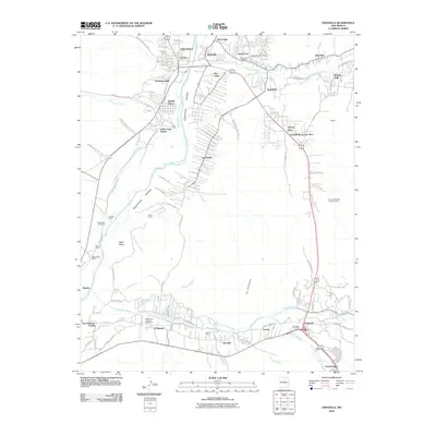
2010 Map of Espanola
USGS Topo · Published 2010About this map
The Española Valley serves as a vital corridor for the Rio Grande, where the river's flow is managed by an intricate network of irrigation channels such as the La Mesilla Ditch and Sombrillo Ditch. This 2010 survey highlights the traditional land patterns of the Santa Clara Pueblo and San Ildefonso Pueblo, juxtaposed with the growing municipal centers of Española and Pojoaque. The landscape is defined by its agricultural heritage, visible in the numerous ranch properties like the Slash-h Ranch and Evans Ranch that dot the riverbanks.
Find a feature on this map
95 named features on this map. Tap any name to fly to it.
Don’t see what you’re looking for? This feature index may not catch every label — zoom into the map to look around manually.
Map Details
Editions of this 2010 Espanola Map
This is the sole edition of this map. No revisions or reprints were ever made.
Other maps of this area

1889 · Santa Fe
USGS Topo · 1:125,000

1892 · Santa Clara
USGS Topo · 1:125,000

1894 · Santa Fe
USGS Topo · 1:125,000

1918 · Abiquiu
USGS Topo · 1:125,000

1952 · White Rock
USGS Topo · 1:24,000

1952 · Puye
USGS Topo · 1:24,000

1953 · Tesuque
USGS Topo · 1:24,000

1953 · Espanola
USGS Topo · 1:24,000

1953 · Chili
USGS Topo · 1:24,000

1953 · San Juan Pueblo
USGS Topo · 1:24,000