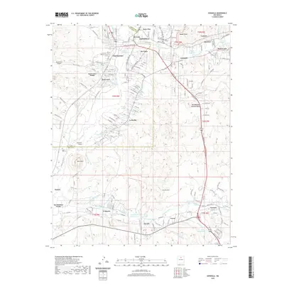
2020 Map of Espanola
USGS Topo · Published 2020About this map
The confluence of the Rio Grande and the Santa Cruz River anchors this 2020 survey of the Espanola Valley. This landscape is defined by its deep cultural history, showing the traditional lands of the Santa Clara Pueblo and San Ildefonso Pueblo alongside the urban center of Española. The settlement pattern follows the valley floor, with communities like Guachupangue, San Pedro, and La Mesilla established along the riverbanks. An intricate system of irrigation is visible through historical water features such as the Quartelez Ditch, Sombrillo Ditch, and La Mesilla Ditch, reflecting centuries of agricultural heritage. To the south, the Pojoaque River meets the Rio Grande near Black Mesa, a prominent geological feature that neighbors the Black Mesa Cem. The map provides an essential record of the contemporary road network, including the Santa Clara Bridge Rd and Cities of Gold Rd, bridging the gap between tribal lands and modern thoroughfares.
Find a feature on this map
175 named features on this map. Tap any name to fly to it.
Don’t see what you’re looking for? This feature index may not catch every label — zoom into the map to look around manually.
Map Details
Editions of this 2020 Espanola Map
This is the sole edition of this map. No revisions or reprints were ever made.
Other maps of this area

1889 · Santa Fe
USGS Topo · 1:125,000

1892 · Santa Clara
USGS Topo · 1:125,000

1894 · Santa Fe
USGS Topo · 1:125,000

1918 · Abiquiu
USGS Topo · 1:125,000

1952 · White Rock
USGS Topo · 1:24,000

1952 · Puye
USGS Topo · 1:24,000

1953 · Tesuque
USGS Topo · 1:24,000

1953 · Espanola
USGS Topo · 1:24,000

1953 · Chili
USGS Topo · 1:24,000

1953 · San Juan Pueblo
USGS Topo · 1:24,000