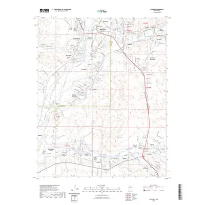
2023 Map of Espanola
USGS Topo · Published 2023About this map
Santa Clara Pueblo and San Ildefonso Pueblo anchor this portion of the northern Rio Grande valley, where centuries of traditional settlement meet the modern growth of Española. The landscape is defined by the braided path of the Rio Grande and its vital irrigation network, including the Vialpando Ditch, Main Canal, and La Mesilla Ditch. These waterways support a string of communities like La Mesilla, El Rancho, and Jaconita that follow the fertile river bench. To the east, the topography rises into the badlands of Los Barrancos, while the prominent volcanic landform of Black Mesa stands as a landmark above the Pajarito area. The map is particularly rich for genealogical research, documenting numerous parish and community burial grounds such as Holy Cross Catholic Cem, New Santa Cruz Cem, and San Ildefonso Cem. The traditional land divisions are further marked by the convergence of the Santa Cruz River and the Pojoaque River, which drain the surrounding high country into the valley floor.
Find a feature on this map
204 named features on this map. Tap any name to fly to it.
Don’t see what you’re looking for? This feature index may not catch every label — zoom into the map to look around manually.
Map Details
Editions of this 2023 Espanola Map
This is the sole edition of this map. No revisions or reprints were ever made.
Other maps of this area

1889 · Santa Fe
USGS Topo · 1:125,000

1892 · Santa Clara
USGS Topo · 1:125,000

1894 · Santa Fe
USGS Topo · 1:125,000

1918 · Abiquiu
USGS Topo · 1:125,000

1952 · White Rock
USGS Topo · 1:24,000

1952 · Puye
USGS Topo · 1:24,000

1953 · Tesuque
USGS Topo · 1:24,000

1953 · Espanola
USGS Topo · 1:24,000

1953 · Chili
USGS Topo · 1:24,000

1953 · San Juan Pueblo
USGS Topo · 1:24,000