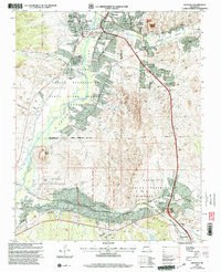
2002 Map of Espanola
USGS Topo · Published 2003About this map
The Rio Grande and Santa Cruz River converge near Espanola, anchoring a landscape defined by ancestral lands and Spanish colonial grants. This 2002 revision by the Forest Service details the complex geography of the Santa Clara Pueblo Grant and the Pojoaque Pueblo Grant, illustrating how modern infrastructure like the Carson Highway overlays centuries-old settlement patterns. Distinctive landmarks such as Black Mesa rise above the valley, while community centers like the Capilla de Santo Niño de Atocha in Santo Niño and the Iglesia de San Antonio de Padua in El Rancho mark the cultural heart of these villages.
Find a feature on this map
58 named features on this map. Tap any name to fly to it.
Don’t see what you’re looking for? This feature index may not catch every label — zoom into the map to look around manually.
Map Details
Editions of this 2002 Espanola Map
This is the sole edition of this map. No revisions or reprints were ever made.
Other maps of this area

1889 · Santa Fe
USGS Topo · 1:125,000

1892 · Santa Clara
USGS Topo · 1:125,000

1894 · Santa Fe
USGS Topo · 1:125,000

1918 · Abiquiu
USGS Topo · 1:125,000

1952 · White Rock
USGS Topo · 1:24,000

1952 · Puye
USGS Topo · 1:24,000

1953 · Tesuque
USGS Topo · 1:24,000

1953 · Espanola
USGS Topo · 1:24,000

1953 · Chili
USGS Topo · 1:24,000

1953 · San Juan Pueblo
USGS Topo · 1:24,000