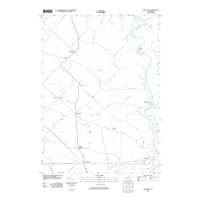
2010 Map of Esperance
USGS Topo · Published 2010About this map
Schoharie Creek carves a significant path through the eastern portion of this landscape, creating a distinct geographical boundary and valley floor near Burtonsville. This corridor is defined by the winding waterway and the small settlement nodes that have anchored the local road network for generations. The map reveals a pattern of rural clusters and named intersections such as Davis Corners, Market Corners, and Lib Corners, which reflect the historic agrarian distribution across the region.
Find a feature on this map
63 named features on this map. Tap any name to fly to it.
Don’t see what you’re looking for? This feature index may not catch every label — zoom into the map to look around manually.
Map Details
Editions of this 2010 Esperance Map
This is the sole edition of this map. No revisions or reprints were ever made.
Other maps of this area

1895 · Amsterdam
USGS Topo · 1:62,500

1896 · Fonda
USGS Topo · 1:62,500

1898 · Fonda
USGS Topo · 1:62,500

1898 · Schoharie
USGS Topo · 1:62,500

1900 · Schoharie
USGS Topo · 1:62,500

1900 · Schoharie
USGS Topo · 1:31,680

1900 · Berne
USGS Topo · 1:62,500

1902 · Fonda
USGS Topo · 1:62,500

1903 · Berne
USGS Topo · 1:62,500

1931 · Amsterdam
USGS Topo · 1:62,500