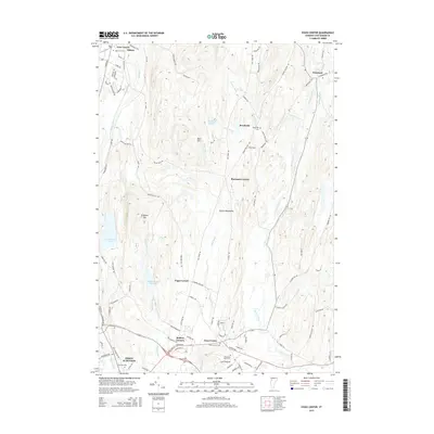
2015 Map of Essex Center
USGS Topo · Published 2015About this map
Essex Center and the surrounding Chittenden County landscape are defined by a network of winding roads and numerous small crossroads settlements. This 2015 survey shows a rural-to-suburban transition, where established centers like Butlers Corners and Pages Corner anchor a geography of family-named hills and winding watercourses. The drainage of the Browns River and its tributaries, including Rogers Brook and Alder Brook, dictates the placement of the area's many cemeteries, such as Mountain View Cem and Essex Center Cem.
Find a feature on this map
98 named features on this map. Tap any name to fly to it.
Don’t see what you’re looking for? This feature index may not catch every label — zoom into the map to look around manually.
Map Details
Editions of this 2015 Essex Center Map
This is the sole edition of this map. No revisions or reprints were ever made.
Other maps of this area

1906 · Burlington
USGS Topo · 1:62,500

1913 · Milton
USGS Topo · 1:48,000

1915 · Milton
USGS Topo · 1:62,500

1919 · Burlington
USGS Topo · 1:62,500

1921 · Richmond
USGS Topo · 1:48,000

1924 · Camels Hump
USGS Topo · 1:62,500

1925 · Mount Mansfield
USGS Topo · 1:48,000

1927 · Mount Mansfield
USGS Topo · 1:62,500

1944 · Milton
USGS Topo · 1:62,500

1944 · Mount Mansfield
USGS Topo · 1:62,500