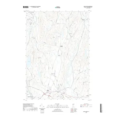
2018 Map of Essex Center
USGS Topo · Published 2018About this map
Essex Junction anchor the southern reach of this Chittenden County landscape, where the sprawling suburban street networks of Essex Junction Village Cem and Fairview Cem give way to the more rural character of central Vermont. The terrain is defined by the Essex Highlands and notable elevations such as Brigham Hill and Bald Hill, which separate the valley drainage of Alder Brook and the Browns River. Historic crossroads and small residential clusters are frequent across the sheet, including Butlers Corners, Pages Corner, and Bowman Corners. To the north, the village of Westford sits near the banks of the Browns River, while the western edge is marked by the natural expanse of Colchester Pond and the Indian Brook Reservoir, highlighting the area's mix of managed water resources and natural wetlands.
Find a feature on this map
101 named features on this map. Tap any name to fly to it.
Don’t see what you’re looking for? This feature index may not catch every label — zoom into the map to look around manually.
Map Details
Editions of this 2018 Essex Center Map
This is the sole edition of this map. No revisions or reprints were ever made.
Other maps of this area

1906 · Burlington
USGS Topo · 1:62,500

1913 · Milton
USGS Topo · 1:48,000

1915 · Milton
USGS Topo · 1:62,500

1919 · Burlington
USGS Topo · 1:62,500

1921 · Richmond
USGS Topo · 1:48,000

1924 · Camels Hump
USGS Topo · 1:62,500

1925 · Mount Mansfield
USGS Topo · 1:48,000

1927 · Mount Mansfield
USGS Topo · 1:62,500

1944 · Milton
USGS Topo · 1:62,500

1944 · Mount Mansfield
USGS Topo · 1:62,500