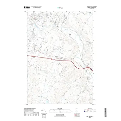
2018 Map of Essex Junction
USGS Topo · Published 2018About this map
The Winooski River winds through this Chittenden County landscape, serving as a geographic anchor for the developed centers of Essex Junction and Williston. The transition from suburban residential grids to the rising elevations of Saxon Hill and Chamberlain Hill is clearly visible, reflecting the area's continued growth within the Green Mountains region. For those tracing local heritage, the map identifies several significant burying grounds, including Holy Family Cem, Village Cem, and the Williston Rd Cem. Educational and community landmarks such as the Pine Ridge School and Kirby Corner are documented alongside numerous tributaries like Indian Brook and Allen Brook. The southern edge of the survey reaches Lake Iroquois, illustrating how the valley's drainage patterns have shaped the historical positioning of transport corridors and rural outposts like Fays Corner.
Find a feature on this map
170 named features on this map. Tap any name to fly to it.
Don’t see what you’re looking for? This feature index may not catch every label — zoom into the map to look around manually.
Map Details
Editions of this 2018 Essex Junction Map
This is the sole edition of this map. No revisions or reprints were ever made.
Other maps of this area

1906 · Burlington
USGS Topo · 1:62,500

1913 · Milton
USGS Topo · 1:48,000

1915 · Milton
USGS Topo · 1:62,500

1919 · Burlington
USGS Topo · 1:62,500

1921 · Richmond
USGS Topo · 1:48,000

1924 · Camels Hump
USGS Topo · 1:62,500

1925 · Mount Mansfield
USGS Topo · 1:48,000

1927 · Mount Mansfield
USGS Topo · 1:62,500

1944 · Milton
USGS Topo · 1:62,500

1944 · Mount Mansfield
USGS Topo · 1:62,500