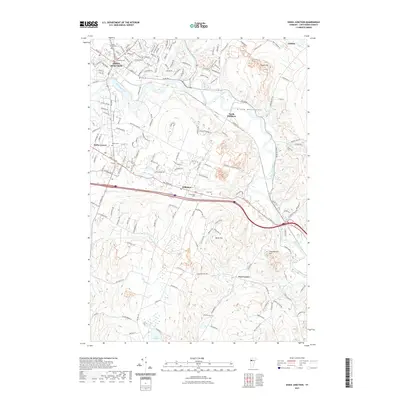
2021 Map of Essex Junction
USGS Topo · Published 2021About this map
The Winooski River carves a central path through this landscape, dividing the urbanized grid of Essex Junction from the upland ridges of Williston. The New England Central RR anchors the northern industrial corridor, passing through a cluster of civic landmarks including the Holy Family Cem and Village Cem. This modern survey reveals a community shaped by its waterways and hills, where the floodplain at North Williston contrasts with the elevations of Saxon Hill and Yantz Hill. Genealogists will find several well-preserved burial grounds, such as Chittenden Cem and Morse Cem, positioned along the older road networks like St George Rd and Williston Rd. The southern portion of the map transitions into more rural terrain, featuring the headwaters of Sucker Brook and the northern tip of Lake Iroquois.
Find a feature on this map
122 named features on this map. Tap any name to fly to it.
Don’t see what you’re looking for? This feature index may not catch every label — zoom into the map to look around manually.
Map Details
Editions of this 2021 Essex Junction Map
This is the sole edition of this map. No revisions or reprints were ever made.
Other maps of this area

1906 · Burlington
USGS Topo · 1:62,500

1913 · Milton
USGS Topo · 1:48,000

1915 · Milton
USGS Topo · 1:62,500

1919 · Burlington
USGS Topo · 1:62,500

1921 · Richmond
USGS Topo · 1:48,000

1924 · Camels Hump
USGS Topo · 1:62,500

1925 · Mount Mansfield
USGS Topo · 1:48,000

1927 · Mount Mansfield
USGS Topo · 1:62,500

1944 · Milton
USGS Topo · 1:62,500

1944 · Mount Mansfield
USGS Topo · 1:62,500