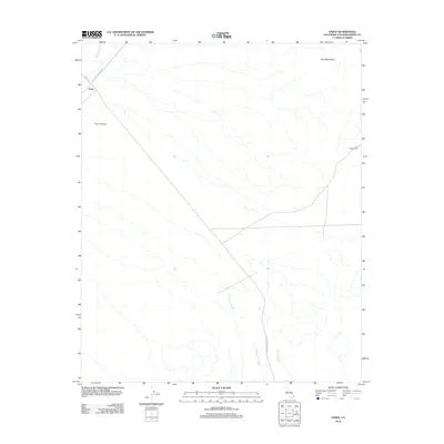
2012 Map of Essex
USGS Topo · Published 2012About this map
Fenner Valley dominates the landscape of this 2012 survey, illustrating the stark topography of the High Desert. The settlement of Essex serves as the primary landmark, situated along the historic corridor of the National Trails Hwy, a route that traces the evolution of cross-country travel through San Bernardino County. To the northeast, the terrain rises into the Piute Mountains, while the desert floor is carved by seasonal drainages such as Honeymoon Wash, Carson Wash, and Watson Wash. The inclusion of the Lazy Daisy Ranch on the eastern edge provides a glimpse into the localized land use and remote ranching outposts that persist in this arid environment. Roads like Essex Rd and Sunflower Springs Rd branch off into the expanse, marking the sparse infrastructure of this Mojave region.
Find a feature on this map
10 named features on this map. Tap any name to fly to it.
Don’t see what you’re looking for? This feature index may not catch every label — zoom into the map to look around manually.
Map Details
Editions of this 2012 Essex Map
This is the sole edition of this map. No revisions or reprints were ever made.
Other maps of this area

1942 · Amboy
USGS Topo · 1:250,000

1943 · Amboy
USGS Topo · 1:250,000

1943 · Essex
USGS Topo · 1:62,500

1943 · Danby
USGS Topo · 1:62,500

1943 · Fenner
USGS Topo · 1:62,500

1954 · Needles
USGS Topo · 1:250,000

1956 · Needles
USGS Topo · 1:250,000

1956 · Fenner
USGS Topo · 1:62,500

1956 · Essex
USGS Topo · 1:62,500

1956 · Colton Well
USGS Topo · 1:62,500