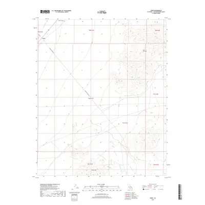
2018 Map of Essex
USGS Topo · Published 2018About this map
Essex sits at the western edge of this survey, serving as a gateway to the arid expanse of the Mojave Desert. The landscape is dominated by the broad Fenner Valley and the rising slopes of the Piute Mountains to the east. Water, though scarce, has shaped the topography through numerous seasonal drainages such as Watson Wash, Carson Wash, and the notably named Honeymoon Wash. To the south, Mercury Mtn provides a distinct landmark for those navigating the desert floor. Remote desert infrastructure is traced via the diagonal route of Sunflower Springs Rd and Essex Rd, which intersect the vast open country. The presence of Barrel Spring in the mountainous terrain highlights a vital historical water source for travelers and local fauna in this high-desert environment.
Find a feature on this map
18 named features on this map. Tap any name to fly to it.
Don’t see what you’re looking for? This feature index may not catch every label — zoom into the map to look around manually.
Map Details
Editions of this 2018 Essex Map
This is the sole edition of this map. No revisions or reprints were ever made.
Other maps of this area

1942 · Amboy
USGS Topo · 1:250,000

1943 · Amboy
USGS Topo · 1:250,000

1943 · Essex
USGS Topo · 1:62,500

1943 · Danby
USGS Topo · 1:62,500

1943 · Fenner
USGS Topo · 1:62,500

1954 · Needles
USGS Topo · 1:250,000

1956 · Needles
USGS Topo · 1:250,000

1956 · Fenner
USGS Topo · 1:62,500

1956 · Essex
USGS Topo · 1:62,500

1956 · Colton Well
USGS Topo · 1:62,500