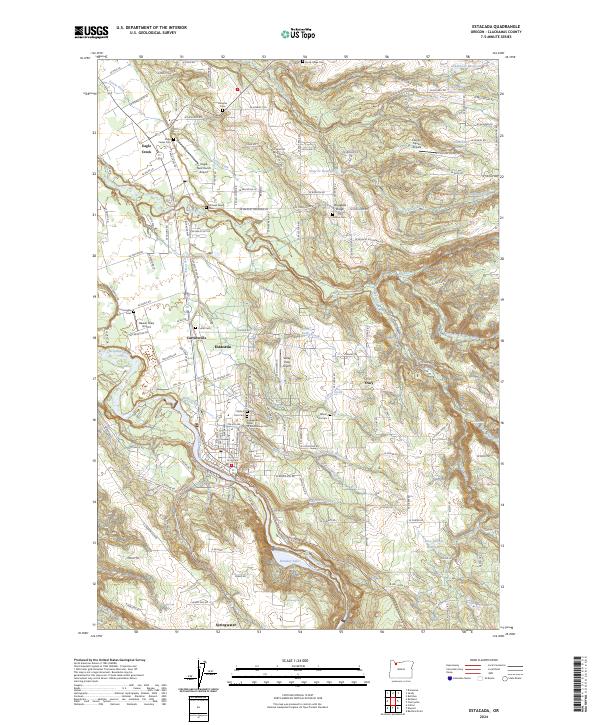
2024 Map of Estacada
USGS Topo · Published 2024About this map
Estacada sits at the heart of this landscape, where the Clackamas River winds through a complex terrain of ridges and creek drainages. The map reveals a dense network of local family history through numerous small burial grounds, including the Philip Foster Cem, Linn Cem, and the Githens Family Cem. These sites, along with the Independent Order Of Odd Fellows Cem, reflect the deep-rooted settlement patterns of this part of Clackamas County.
Find a feature on this map
142 named features on this map. Tap any name to fly to it.
Don’t see what you’re looking for? This feature index may not catch every label — zoom into the map to look around manually.
Map Details
Editions of this 2024 Estacada Map
This is the sole edition of this map. No revisions or reprints were ever made.
Other maps of this area

1911 · Boring
USGS Topo · 1:48,000

1914 · Boring
USGS Topo · 1:62,500

1916 · Estacada
USGS Topo · 1:125,000

1940 · Boring
USGS Topo · 1:62,500

1948 · Vancouver
USGS Topo · 1:250,000

1950 · Vancouver
USGS Topo · 1:250,000

1950 · Vancouver
USGS Topo · 1:250,000
1954 · Damascus
USGS Topo · 1:24,000
1954 · Sandy
USGS Topo · 1:24,000
1954 · Redland
USGS Topo · 1:24,000