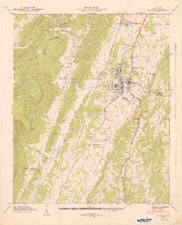
1947 Map of Estelle
USGS Topo · Published 1948About this map
La Fayette serves as the focal point of this postwar Georgia landscape, where the Central of Georgia railroad intersects with major regional thoroughfares like the William Howard Taft Memorial Highway. The topography is defined by the dramatic ascent of Pigeon Mountain to the west and the parallel alignment of Straight Ridge and Peavine Ridge. The settlement pattern reflects a deeply rooted rural society, with institutional landmarks such as the County Farm and the Log Cabin Tabernacle situated near the town center. Local industry and agriculture are visible through features like Blaylock Mill and the Pumping Station on Town Creek. Genealogists will find significant value in the documentation of scattered rural burial grounds and schools, including the Shaw Cem and Burnt Mill Sch, which anchored small communities like Valley Head and Estelle before the mid-century shift toward more centralized development.
Find a feature on this map
87 named features on this map. Tap any name to fly to it.
Don’t see what you’re looking for? This feature index may not catch every label — zoom into the map to look around manually.
Map Details
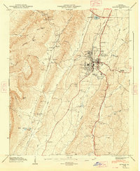
Editions of this 1947 Estelle Map
2 editions found
Other maps of this area

1886 · Ringgold
USGS Topo · 1:125,000

1892 · Ringgold
USGS Topo · 1:125,000

1935 · Catlett
USGS Topo · 1:24,000

1935 · Durham
USGS Topo · 1:24,000

1935 · Nickajack Gap
USGS Topo · 1:24,000

1936 · Kensington
USGS Topo · 1:24,000

1936 · Estelle
USGS Topo · 1:24,000
1936 · Dougherty Gap
USGS Topo · 1:24,000
1936 · Cedar Grove
USGS Topo · 1:24,000

1946 · Kensington
USGS Topo · 1:24,000