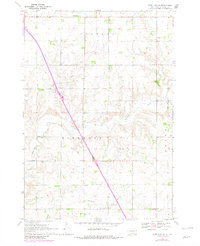
1970 Map of Estelline NE
USGS Topo · Published 1982About this map
Hidewood Creek and Bullhead Run carve through the agricultural landscape of Deuel County, defining the drainage patterns of several established townships. The map illustrates a rural territory organized by the townships of Havana, Hidewood, Brandt, Grange, and Blom, where Section 16 of Hidewood Township is anchored by a local Townhall. These townships represent the foundational grid of early South Dakota settlement, where land use is primarily divided between expansive fields and infrastructure like the Gravel Pits. Local genealogy and community history are preserved at Tabor Cem in the north and Rose Cem near the eastern boundary. Modern transitions are visible in the 1970s updates, which show a prominent highway route including a Radio Tower and a highway Rest Area, reflecting the shift toward increased regional transit through this prairie region.
Find a feature on this map
14 named features on this map. Tap any name to fly to it.
Don’t see what you’re looking for? This feature index may not catch every label — zoom into the map to look around manually.
Map Details
Editions of this 1970 Estelline NE Map
2 editions found
Other maps of this area

1953 · Watertown
USGS Topo · 1:250,000

1958 · Watertown
USGS Topo · 1:250,000

1969 · Dempster
USGS Topo · 1:24,000

1970 · Kranzburg SW
USGS Topo · 1:24,000

1970 · Bemis
USGS Topo · 1:24,000

1970 · Clear Lake South
USGS Topo · 1:24,000

1970 · Estelline SE
USGS Topo · 1:24,000

1970 · Estelline
USGS Topo · 1:24,000

1970 · Estelline NE
USGS Topo · 1:24,000

1970 · Toronto
USGS Topo · 1:24,000