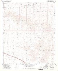
1979 Map of Estrella
USGS Topo · Published 1980About this map
The Maricopa Mountains dominate this 1979 survey, rising sharply above the desert floor and defining the topography of this arid landscape. Along the northern edge of the range, the Southern Pacific railroad corridor serves as the primary artery for travel and transport, linking small trackside points such as Estrella and Shawmut. These locations, along with Ocopos, represent the sparse but vital settlement pattern typical of the western Arizona desert during the late twentieth century, where development was dictated by rail access and water availability.
Find a feature on this map
9 named features on this map. Tap any name to fly to it.
Don’t see what you’re looking for? This feature index may not catch every label — zoom into the map to look around manually.
Map Details
Editions of this 1979 Estrella Map
2 editions found
Other maps of this area

1951 · Estrella
USGS Topo · 1:62,500

1951 · Gila Bend
USGS Topo · 1:62,500

1951 · Mobile
USGS Topo · 1:62,500

1951 · Cotton Center
USGS Topo · 1:62,500

1953 · Ajo
USGS Topo · 1:250,000

1954 · Phoenix
USGS Topo · 1:250,000

1957 · Ajo
USGS Topo · 1:250,000

1957 · Phoenix
USGS Topo · 1:250,000

1958 · Ajo
USGS Topo · 1:250,000

1958 · Phoenix
USGS Topo · 1:250,000