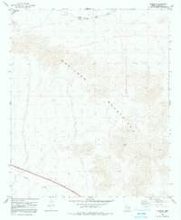
1979 Map of Estrella
USGS Topo · Published 1991About this map
The Maricopa Mountains dominate this 1979 survey, with the high point at Big Horn rising above the surrounding desert floor. This arid landscape is defined by the vital infrastructure of the Southern Pacific railroad, which cuts through the northern portion of the quadrangle. Along these tracks, small rail-related sidings and settlements like Estrella, Shawmut, and Ocapos provide the only human anchor points in an otherwise vast expanse of high-relief terrain. The passage of the railroad here illustrates the historic importance of this corridor for transcontinental transit across the Arizona desert.
Find a feature on this map
10 named features on this map. Tap any name to fly to it.
Don’t see what you’re looking for? This feature index may not catch every label — zoom into the map to look around manually.
Map Details
Editions of this 1979 Estrella Map
2 editions found
Other maps of this area

1951 · Estrella
USGS Topo · 1:62,500

1951 · Gila Bend
USGS Topo · 1:62,500

1951 · Mobile
USGS Topo · 1:62,500

1951 · Cotton Center
USGS Topo · 1:62,500

1953 · Ajo
USGS Topo · 1:250,000

1954 · Phoenix
USGS Topo · 1:250,000

1957 · Ajo
USGS Topo · 1:250,000

1957 · Phoenix
USGS Topo · 1:250,000

1958 · Ajo
USGS Topo · 1:250,000

1958 · Phoenix
USGS Topo · 1:250,000