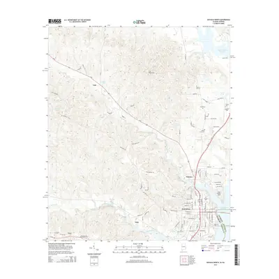
2014 Map of Eufaula North
USGS Topo · Published 2014About this map
Eufaula serves as the focal point for this landscape along the Alabama-Georgia border, where the western reaches of the Walter F George Reservoir meet the rolling woodlands of Barbour County. The area is defined by the convergence of major transit corridors like Us-82 and Us-431, which connect smaller outlying settlements such as Lugo, Hoboken, and Tullis. North of the city, Weedon Field provides a regional aviation hub while local hydrology is dominated by the winding paths of Chewalla Creek and Barbour Creek. Genealogists will find a high density of rural burial grounds, including the Haven of Rest Cem, McGee Cem, and Antioch Cem. These small family and community landmarks, alongside the prominent Saint Francis Point, offer a detailed look at the land use and legacy of the Chattahoochee River valley in the early 21st century.
Find a feature on this map
92 named features on this map. Tap any name to fly to it.
Don’t see what you’re looking for? This feature index may not catch every label — zoom into the map to look around manually.
Map Details
Editions of this 2014 Eufaula North Map
This is the sole edition of this map. No revisions or reprints were ever made.
Other maps of this area

1953 · Dothan
USGS Topo · 1:250,000

1954 · Dothan
USGS Topo · 1:250,000

1955 · Dothan
USGS Topo · 1:250,000

1955 · Phenix City
USGS Topo · 1:250,000

1957 · Phenix City
USGS Topo · 1:250,000

1958 · Phenix City
USGS Topo · 1:250,000

1967 · Hatcher
USGS Topo · 1:24,000

1967 · Georgetown
USGS Topo · 1:24,000

1968 · Eufaula North
USGS Topo · 1:24,000

1968 · Baker Hill
USGS Topo · 1:24,000