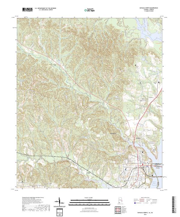
2024 Map of Eufaula North
USGS Topo · Published 2024About this map
Eufaula sits as a primary anchor on this Barbour County landscape, overlooking the wide expanse of the Walter F George Reservoir along the Georgia border. The map documents the city's modern street grid, including N Eufaula Ave and W Broad St, which lead toward the Barbour - Eufaula County Courthouse. North of the city, the Eufaula National Wildlife Refuge preserves the riverine ecosystem, while the interior terrain is marked by smaller settlements like Hoboken and Lugo.
Find a feature on this map
64 named features on this map. Tap any name to fly to it.
Don’t see what you’re looking for? This feature index may not catch every label — zoom into the map to look around manually.
Map Details
Editions of this 2024 Eufaula North Map
This is the sole edition of this map. No revisions or reprints were ever made.
Other maps of this area

1953 · Dothan
USGS Topo · 1:250,000

1954 · Dothan
USGS Topo · 1:250,000

1955 · Dothan
USGS Topo · 1:250,000

1955 · Phenix City
USGS Topo · 1:250,000

1957 · Phenix City
USGS Topo · 1:250,000

1958 · Phenix City
USGS Topo · 1:250,000

1967 · Hatcher
USGS Topo · 1:24,000

1967 · Georgetown
USGS Topo · 1:24,000

1968 · Eufaula North
USGS Topo · 1:24,000

1968 · Baker Hill
USGS Topo · 1:24,000