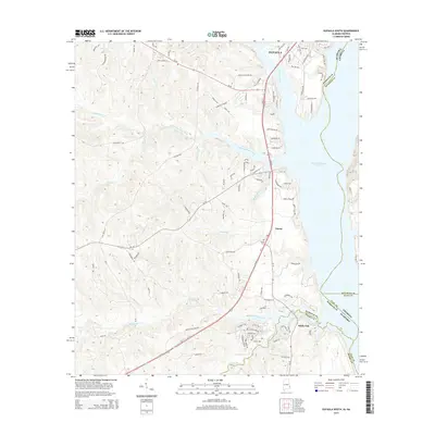
2014 Map of Eufaula South
USGS Topo · Published 2014About this map
Walter F George Reservoir dominates the eastern edge of this Alabama-Georgia borderland, a massive impoundment of the Chattahoochee River that defines the local geography. Along its western banks, the southern outskirts of Eufaula give way to a landscape shaped by significant drainage systems, including Cheneyhatchee Creek, Barbour Creek, and White Oak Creek. These waterways carve through the terrain as they flow toward the reservoir, with smaller tributaries like Blacks Branch and Sandy Creek branching into the interior.
Find a feature on this map
106 named features on this map. Tap any name to fly to it.
Don’t see what you’re looking for? This feature index may not catch every label — zoom into the map to look around manually.
Map Details
Editions of this 2014 Eufaula South Map
This is the sole edition of this map. No revisions or reprints were ever made.
Other maps of this area

1953 · Dothan
USGS Topo · 1:250,000

1954 · Dothan
USGS Topo · 1:250,000

1955 · Dothan
USGS Topo · 1:250,000

1967 · Hatcher
USGS Topo · 1:24,000

1967 · Georgetown
USGS Topo · 1:24,000

1968 · Eufaula North
USGS Topo · 1:24,000

1968 · Baker Hill
USGS Topo · 1:24,000

1968 · White Oak
USGS Topo · 1:24,000

1968 · Eufaula South
USGS Topo · 1:24,000

1969 · Fort Gaines NW
USGS Topo · 1:24,000