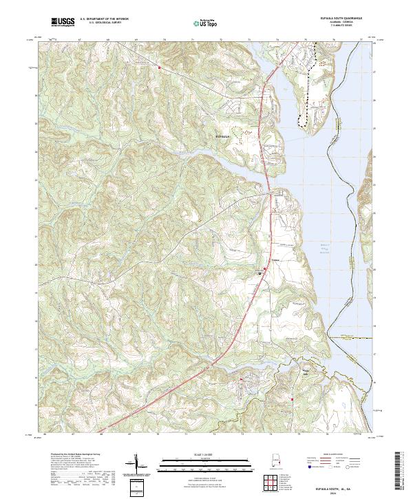
2024 Map of Eufaula South
USGS Topo · Published 2024About this map
The Eufaula riverfront along the Walter F George Reservoir anchors this topographic study of Barbour County's eastern edge. The map reveals the southern expansion of the city and its relationship to the Alabama-Georgia state line, which follows the winding course of the inundated river valley. Moving inland, the landscape transitions into a network of creek drainages including Cheneyhatchee Creek, Chipola Creek, and White Oak Creek. Small communities and family landmarks are preserved in the documentation of Terese and White Oak, while the Sardis Cem stands as a local genealogical waypoint. The survey captures the modern infrastructure of the region, from the residential clusters along S Eufaula Ave to the industrial corridors near State Docks Rd, illustrating the intersection of historic settlement patterns and contemporary development along the reservoir's shores.
Find a feature on this map
94 named features on this map. Tap any name to fly to it.
Don’t see what you’re looking for? This feature index may not catch every label — zoom into the map to look around manually.
Map Details
Editions of this 2024 Eufaula South Map
This is the sole edition of this map. No revisions or reprints were ever made.
Other maps of this area

1953 · Dothan
USGS Topo · 1:250,000

1954 · Dothan
USGS Topo · 1:250,000

1955 · Dothan
USGS Topo · 1:250,000

1967 · Hatcher
USGS Topo · 1:24,000

1967 · Georgetown
USGS Topo · 1:24,000

1968 · Eufaula North
USGS Topo · 1:24,000

1968 · Baker Hill
USGS Topo · 1:24,000

1968 · White Oak
USGS Topo · 1:24,000

1968 · Eufaula South
USGS Topo · 1:24,000

1969 · Fort Gaines NW
USGS Topo · 1:24,000