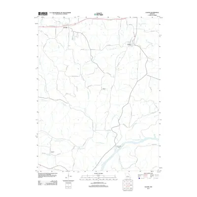
2011 Map of Eugene
USGS Topo · Published 2011About this map
The Osage River winds through the southern reaches of this Miller County landscape, defining the terrain around Coon Creek Island. To the north, the small settlements of Etterville and Eugene serve as local hubs, connected by a network of rural roads such as Castlewood Rd and Route BB. The area is characterized by a dense drainage system, where waterways like Jack Buster Creek and Little Saline Creek carve through the countryside.
Find a feature on this map
64 named features on this map. Tap any name to fly to it.
Don’t see what you’re looking for? This feature index may not catch every label — zoom into the map to look around manually.
Map Details
Editions of this 2011 Eugene Map
This is the sole edition of this map. No revisions or reprints were ever made.
Other maps of this area

1888 · Versailles
USGS Topo · 1:125,000

1888 · Tuscumbia
USGS Topo · 1:125,000

1893 · Versailles
USGS Topo · 1:125,000

1894 · Tuscumbia
USGS Topo · 1:125,000

1904 · Eldon
USGS Topo · 1:62,500

1932 · Versailles No 4
USGS Topo · 1:48,000

1933 · Iberia
USGS Topo · 1:62,500

1934 · Bagnell
USGS Topo · 1:24,000
1935 · Eldon
USGS Topo · 1:24,000

1937 · Iberia
USGS Topo · 1:62,500