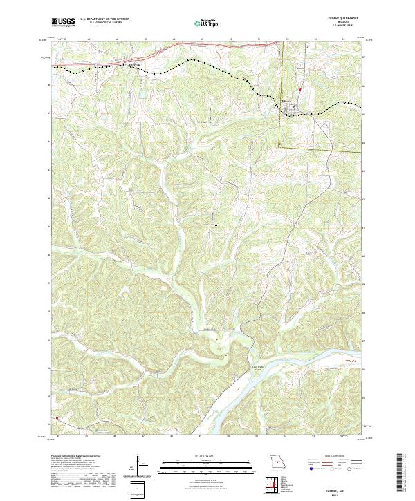
2021 Map of Eugene
USGS Topo · Published 2021About this map
Eugene and Etterville anchor this mid-Missouri landscape where the rolling hills of Cole and Miller counties meet the winding course of the Osage River. The terrain is deeply incised by a network of drainage systems, including Saline Creek, Little Saline Cr, and Little Tavern Cr, which have historically dictated the placement of roads like Gageville Rd and Central Hill Rd. Small family or community burial grounds such as Gageville Cem and Thompson Cem are tucked away from the main thoroughfares, providing vital points of reference for local historians.
Find a feature on this map
69 named features on this map. Tap any name to fly to it.
Don’t see what you’re looking for? This feature index may not catch every label — zoom into the map to look around manually.
Map Details
Editions of this 2021 Eugene Map
This is the sole edition of this map. No revisions or reprints were ever made.
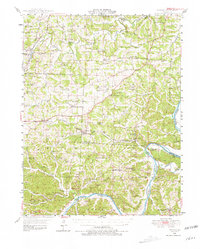
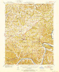
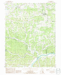
Historical Maps of Eugene Through Time
4 maps found