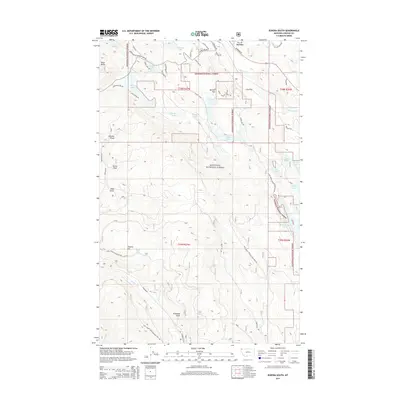
2014 Map of Eureka South
USGS Topo · Published 2014About this map
The Tobacco River winds through the northern reaches of this landscape just south of the Canadian border, defining a valley dominated by glacial lakes and timbered slopes within the Kootenai National Forest. Significant elevation changes are marked by Black Butte in the northwest and Virginia Hill further south, with numerous named drainages such as Workman Draw and Johnson Draw carving through the terrain. A dense network of forest roads, including Natl Forest Develop Road 7147 Rd and Pinkham Rd, provides access to remote water bodies like Thirsty Lake and Alkali Lake. This 2014 survey documents the complex system of forest management routes and the natural hydrology of the Pinkham Cr watershed, offering a detailed record of the wilderness infrastructure and topography south of the town center.
Find a feature on this map
51 named features on this map. Tap any name to fly to it.
Don’t see what you’re looking for? This feature index may not catch every label — zoom into the map to look around manually.
Map Details
Editions of this 2014 Eureka South Map
This is the sole edition of this map. No revisions or reprints were ever made.
Other maps of this area

1913 · Stryker
USGS Topo · 1:125,000

1916 · Stryker
USGS Topo · 1:125,000

1957 · Kalispell
USGS Topo · 1:250,000

1960 · Kalispell
USGS Topo · 1:250,000

1961 · Kalispell
USGS Topo · 1:250,000

1963 · Rexford
USGS Topo · 1:24,000

1963 · Eureka North
USGS Topo · 1:24,000

1963 · Mc Guire Mountain
USGS Topo · 1:24,000

1963 · Ksanka Peak
USGS Topo · 1:24,000

1963 · Eureka South
USGS Topo · 1:24,000