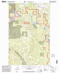
1997 Map of Eureka South
USGS Topo · Published 2000About this map
The Eureka Corporate Boundary serves as the focal point for this 1990s-era revision, where the southern edge of town meets the expansive terrain of the Kootenai National Forest. A network of water bodies, including the strangely named Thirsty Lake and Alkali Lake, define the central basin, while the Tobacco River flows through the northeastern corner near the Rexford Ranger District.
Find a feature on this map
31 named features on this map. Tap any name to fly to it.
Don’t see what you’re looking for? This feature index may not catch every label — zoom into the map to look around manually.
Map Details
Editions of this 1997 Eureka South Map
This is the sole edition of this map. No revisions or reprints were ever made.
Other maps of this area

1913 · Stryker
USGS Topo · 1:125,000

1916 · Stryker
USGS Topo · 1:125,000

1957 · Kalispell
USGS Topo · 1:250,000

1960 · Kalispell
USGS Topo · 1:250,000

1961 · Kalispell
USGS Topo · 1:250,000

1963 · Rexford
USGS Topo · 1:24,000

1963 · Eureka North
USGS Topo · 1:24,000

1963 · Mc Guire Mountain
USGS Topo · 1:24,000

1963 · Ksanka Peak
USGS Topo · 1:24,000

1963 · Eureka South
USGS Topo · 1:24,000