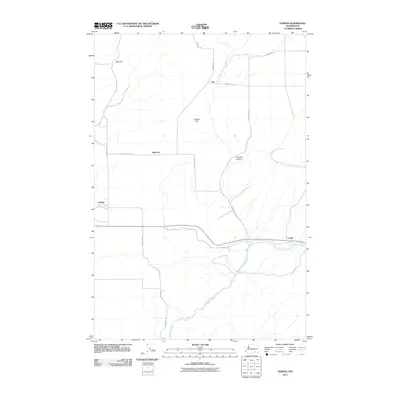
2011 Map of Eureka
USGS Topo · Published 2011About this map
The Touchet River flows through the southern portion of this region, shaping a landscape defined by agricultural stretches and geological features like Eureka Flat and Winnett Canyon. This Walla Walla County survey captures the small, distributed settlements of Eureka, Babcock, Lamar, and Lee, which are connected by a network of local thoroughfares including Uptown Rd and Greenville Rd. The topography rises toward Rice Hill in the northwest, transitioning into the flatter plains that historically supported the region's dryland farming. The layout of these named junctions and rural roads reflects the enduring agricultural character of the area in the early twenty-first century, providing a clear record of the land ownership and transportation patterns established over generations of cultivation.
Find a feature on this map
16 named features on this map. Tap any name to fly to it.
Don’t see what you’re looking for? This feature index may not catch every label — zoom into the map to look around manually.
Map Details
Editions of this 2011 Eureka Map
This is the sole edition of this map. No revisions or reprints were ever made.
Other maps of this area

1915 · Wallulah
USGS Topo · 1:96,000

1918 · Wallula
USGS Topo · 1:125,000

1919 · Walla Walla
USGS Topo · 1:125,000

1921 · Walla Walla
USGS Topo · 1:125,000

1953 · Walla Walla
USGS Topo · 1:250,000

1958 · Walla Walla
USGS Topo · 1:250,000

1966 · Page
USGS Topo · 1:24,000

1966 · Snake River
USGS Topo · 1:24,000

1966 · Rulo
USGS Topo · 1:24,000

1966 · Hadley
USGS Topo · 1:24,000