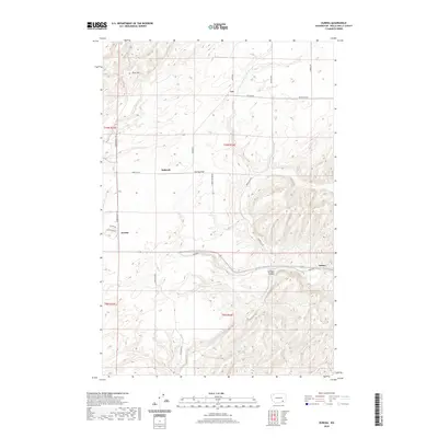
2020 Map of Eureka
USGS Topo · Published 2020About this map
Eureka Flat dominates this portion of Walla Walla County, characterized by the expansive agricultural landscape and the systematic grid of the Public Land Survey System. The small settlements of Eureka, Babcock, and Lee serve as focal points for the surrounding rural sections, connected by a network of local roads including Eureka North Rd and Alonzo Walker Rd. To the south and east, the terrain shifts into the more complex topography of Winnett Canyon as it approaches the Touchet River valley. This 2020 map documents the persistent rural character of the region, where family names are often preserved in the geography, such as Rice Hill and numerous named rural routes like Struthers Rd and Harsell Rd. The proximity of Lamar to the canyon landscape illustrates the transition between the high flats and the river drainage systems.
Find a feature on this map
24 named features on this map. Tap any name to fly to it.
Don’t see what you’re looking for? This feature index may not catch every label — zoom into the map to look around manually.
Map Details
Editions of this 2020 Eureka Map
This is the sole edition of this map. No revisions or reprints were ever made.
Other maps of this area

1915 · Wallulah
USGS Topo · 1:96,000

1918 · Wallula
USGS Topo · 1:125,000

1919 · Walla Walla
USGS Topo · 1:125,000

1921 · Walla Walla
USGS Topo · 1:125,000

1953 · Walla Walla
USGS Topo · 1:250,000

1958 · Walla Walla
USGS Topo · 1:250,000

1966 · Page
USGS Topo · 1:24,000

1966 · Snake River
USGS Topo · 1:24,000

1966 · Rulo
USGS Topo · 1:24,000

1966 · Hadley
USGS Topo · 1:24,000