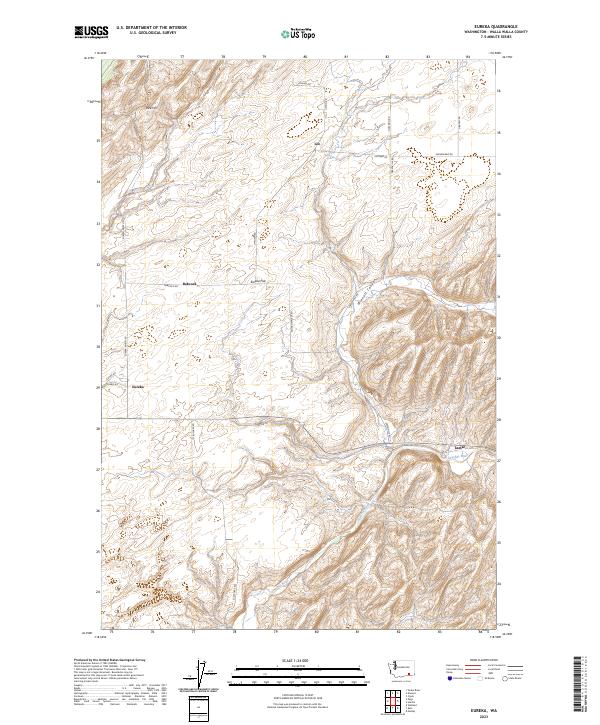
2023 Map of Eureka
USGS Topo · Published 2023About this map
Eureka Flat dominates the central landscape of this Walla Walla County survey, illustrating the characteristic topography of Washington's dryland wheat country. The settlement of Eureka serves as a primary reference point in the western portion of the map, while the Touchet River meanders through the southern reaches, providing the most significant drainage for the surrounding slopes and canyons. To the east, the terrain becomes more complex as Winnett Canyon cuts through the uplands near Lamar. A network of rural routes, including Uptown Rd and Struthers Rd, connects isolated points like Lee and Babcock, tracing the section lines and natural contours of a region defined by its agricultural legacy. The prominence of Rice Hill in the northwest provides a distinctive landmark overlooking the vast, open expanses that have long supported the local farm economy.
Find a feature on this map
24 named features on this map. Tap any name to fly to it.
Don’t see what you’re looking for? This feature index may not catch every label — zoom into the map to look around manually.
Map Details
Editions of this 2023 Eureka Map
This is the sole edition of this map. No revisions or reprints were ever made.
Other maps of this area

1915 · Wallulah
USGS Topo · 1:96,000

1918 · Wallula
USGS Topo · 1:125,000

1919 · Walla Walla
USGS Topo · 1:125,000

1921 · Walla Walla
USGS Topo · 1:125,000

1953 · Walla Walla
USGS Topo · 1:250,000

1958 · Walla Walla
USGS Topo · 1:250,000

1966 · Page
USGS Topo · 1:24,000

1966 · Snake River
USGS Topo · 1:24,000

1966 · Rulo
USGS Topo · 1:24,000

1966 · Hadley
USGS Topo · 1:24,000