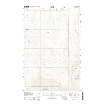
2014 Map of Evans
USGS Topo · Published 2014About this map
Evans serves as the primary focal point of this rural Cascade County landscape, situated where Evans Riceville Rd meets the headwaters of Sand Coulee Cr. The map reveals a complex network of drainages including Half Breed Cr, Middle Fork Sand Coulee Cr, and E Fork Sand Coulee Cr, illustrating the deeply eroded terrain of the High Plains as it transitions toward the mountain front. To the southeast, the elevation rises toward Tiger Butte and the rugged timber of the Lewis & Clark National Forest.
Find a feature on this map
22 named features on this map. Tap any name to fly to it.
Don’t see what you’re looking for? This feature index may not catch every label — zoom into the map to look around manually.
Map Details
Editions of this 2014 Evans Map
This is the sole edition of this map. No revisions or reprints were ever made.
Other maps of this area

1886 · Great Falls
USGS Topo · 1:250,000

1890 · Fort Benton
USGS Topo · 1:250,000

1892 · Fort Benton
USGS Topo · 1:250,000

1897 · Fort Benton
USGS Topo · 1:250,000

1954 · Great Falls
USGS Topo · 1:250,000

1955 · Stockett
USGS Topo · 1:62,500

1956 · Belt
USGS Topo · 1:62,500

1957 · Great Falls
USGS Topo · 1:250,000
1965 · Stockett
USGS Topo · 1:24,000

1965 · Mahoney Hill
USGS Topo · 1:24,000