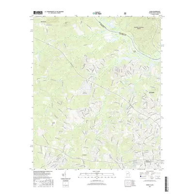
2017 Map of Evans
USGS Topo · Published 2017About this map
Sumter National Forest dominates the northern reaches of this Georgia landscape, bordering the Savannah River as it defines the boundary with South Carolina. The terrain transitions from the elevation of Burks Mtn in the northwest to a dense suburban network concentrated around Evans and Lewiston. This era of development is evidenced by numerous subdivisions and man-made lakes, including Columbia Land Corporation Lake, Camelot Lake, and Woodbridge Lake, which have reshaped the drainage patterns of Kiokee Creek and Uchee Cr.
Find a feature on this map
225 named features on this map. Tap any name to fly to it.
Don’t see what you’re looking for? This feature index may not catch every label — zoom into the map to look around manually.
Map Details
Editions of this 2017 Evans Map
This is the sole edition of this map. No revisions or reprints were ever made.
Other maps of this area

1892 · Mc Cormick
USGS Topo · 1:125,000

1912 · Mc Cormick
USGS Topo · 1:125,000

1920 · Clarks Hill
USGS Topo · 1:48,000

1921 · Clarks Hill
USGS Topo · 1:62,500

1921 · Appling
USGS Topo · 1:62,500

1922 · Harlem
USGS Topo · 1:62,500

1922 · Hephzibah
USGS Topo · 1:62,500

1941 · Clarks Hill
USGS Topo · 1:62,500

1942 · Clarks Hill
USGS Topo · 1:62,500

1943 · Appling
USGS Topo · 1:62,500