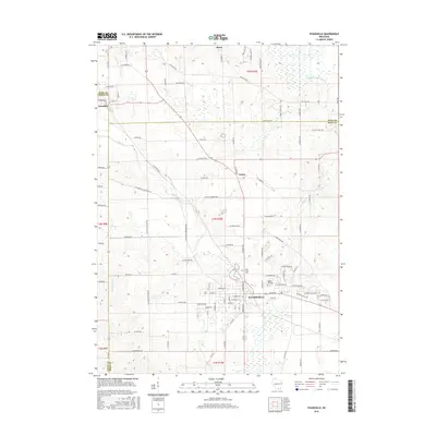
2016 Map of Evansville
USGS Topo · Published 2016About this map
Evansville serves as the primary hub of this landscape, situated at the confluence of several townships where Rock, Dane, and Green counties meet. The town's layout is centered around its historic thoroughfares like W Main St and Water St, with Lake Leota providing a focal point for the community's northern edge. To the north, the small settlements of Union and Stone appear along a grid of rural roads, including W Union Rd and Old Stage Rd, which trace the agricultural patterns of the early twenty-first century. Local history is anchored by sites like Maple Hill Cem and Holy Cross Cem on the outskirts of Evansville. The geography is defined by a network of waterways, with Allen Cr and Badfish Creek winding through the terrain, while the far northwest corner of the map captures a portion of Brooklyn where it straddles the Dane and Green county line.
Find a feature on this map
65 named features on this map. Tap any name to fly to it.
Don’t see what you’re looking for? This feature index may not catch every label — zoom into the map to look around manually.
Map Details
Editions of this 2016 Evansville Map
This is the sole edition of this map. No revisions or reprints were ever made.
Other maps of this area

1889 · Evansville
USGS Topo · 1:62,500

1890 · Stoughton
USGS Topo · 1:62,500

1891 · Janesville
USGS Topo · 1:62,500

1893 · Janesville
USGS Topo · 1:62,500

1893 · Brodhead
USGS Topo · 1:62,500

1894 · Evansville
USGS Topo · 1:62,500

1906 · Evansville
USGS Topo · 1:62,500

1954 · Rockford
USGS Topo · 1:250,000

1955 · Rockford
USGS Topo · 1:250,000

1958 · Rockford
USGS Topo · 1:250,000