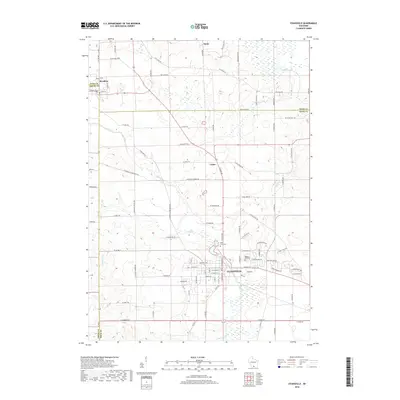
2018 Map of Evansville
USGS Topo · Published 2018About this map
Evansville serves as the primary hub of this Rock County landscape, situated at the junction of several regional routes and the meandering Allen Cr. The surrounding terrain transitions between established agricultural plots and significant wetland systems, most notably around the northern reaches of Badfish Creek. This 2018 survey reveals a well-defined rural grid where smaller settlements like Union and Brooklyn anchor the northwestern and central-northern sections. Genealogists and local historians can pinpoint long-standing community landmarks, including Holy Cross Cem and Maple Hill Cem on the outskirts of the main town. The drainage patterns of Spring Cr and Cold Spring Cr illustrate the hydrological character of the southern portion of the quadrangle, which remains largely defined by its township-and-range road layout and local features like the prominent Stone elevation.
Find a feature on this map
97 named features on this map. Tap any name to fly to it.
Don’t see what you’re looking for? This feature index may not catch every label — zoom into the map to look around manually.
Map Details
Editions of this 2018 Evansville Map
This is the sole edition of this map. No revisions or reprints were ever made.
Other maps of this area

1889 · Evansville
USGS Topo · 1:62,500

1890 · Stoughton
USGS Topo · 1:62,500

1891 · Janesville
USGS Topo · 1:62,500

1893 · Janesville
USGS Topo · 1:62,500

1893 · Brodhead
USGS Topo · 1:62,500

1894 · Evansville
USGS Topo · 1:62,500

1906 · Evansville
USGS Topo · 1:62,500

1954 · Rockford
USGS Topo · 1:250,000

1955 · Rockford
USGS Topo · 1:250,000

1958 · Rockford
USGS Topo · 1:250,000