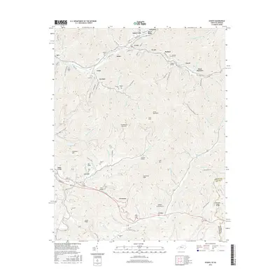
2016 Map of Evarts
USGS Topo · Published 2016About this map
Evarts and the coal-mining communities of the Clover Fork Cumberland River valley are shown in detail during the mid-2010s. This survey illustrates the dense settlement patterns along the valley floor, where towns like Verda, Kildav, and Ages follow the river's winding path beneath the high ridges of Cumberland Mountain and Black Mountain. The map is particularly useful for genealogists, as it identifies numerous family-named burial grounds, including Middleton Cem, Burkhart Cem, and the Wash Smith Cem near Cranks.
Find a feature on this map
115 named features on this map. Tap any name to fly to it.
Don’t see what you’re looking for? This feature index may not catch every label — zoom into the map to look around manually.
Map Details
Editions of this 2016 Evarts Map
This is the sole edition of this map. No revisions or reprints were ever made.
Other maps of this area

1887 · Jonesville
USGS Topo · 1:125,000

1891 · Jonesville
USGS Topo · 1:125,000

1903 · Harlan
USGS Topo · 1:48,000

1916 · Harlan
USGS Topo · 1:48,000

1916 · Nolansburg
USGS Topo · 1:48,000

1919 · Nolansburg
USGS Topo · 1:62,500

1919 · Harlan
USGS Topo · 1:62,500

1932 · Hagan
USGS Topo · 1:62,500

1935 · Hubbard Springs
USGS Topo · 1:24,000
1935 · Evarts
USGS Topo · 1:24,000