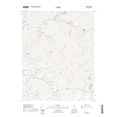
2019 Map of Evarts
USGS Topo · Published 2019About this map
Cumberland Mountain forms the backbone of this topographical study in Harlan County, where the Clover Fork Cumberland River winds through narrow valleys once defined by coal mining communities. The settlement of Evarts serves as a central hub, surrounded by a constellation of smaller locales like Kildav, Verda, and Ten Spot. The landscape is etched with the remnants of industrial history, from Hospital Hill in Kenvir to the steep grades of Black Mountain. Genealogy researchers will find significant detail in the placement of family-named burial sites, including the Wash Smith Cem near Cranks and the Howard Cem along the southern slopes. Further south, the Martins Fork Cumberland River flows toward the Tennessee Valley Divide, marking the boundary between Kentucky and Virginia.
Find a feature on this map
124 named features on this map. Tap any name to fly to it.
Don’t see what you’re looking for? This feature index may not catch every label — zoom into the map to look around manually.
Map Details
Editions of this 2019 Evarts Map
This is the sole edition of this map. No revisions or reprints were ever made.
Other maps of this area

1887 · Jonesville
USGS Topo · 1:125,000

1891 · Jonesville
USGS Topo · 1:125,000

1903 · Harlan
USGS Topo · 1:48,000

1916 · Harlan
USGS Topo · 1:48,000

1916 · Nolansburg
USGS Topo · 1:48,000

1919 · Nolansburg
USGS Topo · 1:62,500

1919 · Harlan
USGS Topo · 1:62,500

1932 · Hagan
USGS Topo · 1:62,500

1935 · Hubbard Springs
USGS Topo · 1:24,000
1935 · Evarts
USGS Topo · 1:24,000