2022 Map of Evarts
USGS Topo · Published 2022About this map
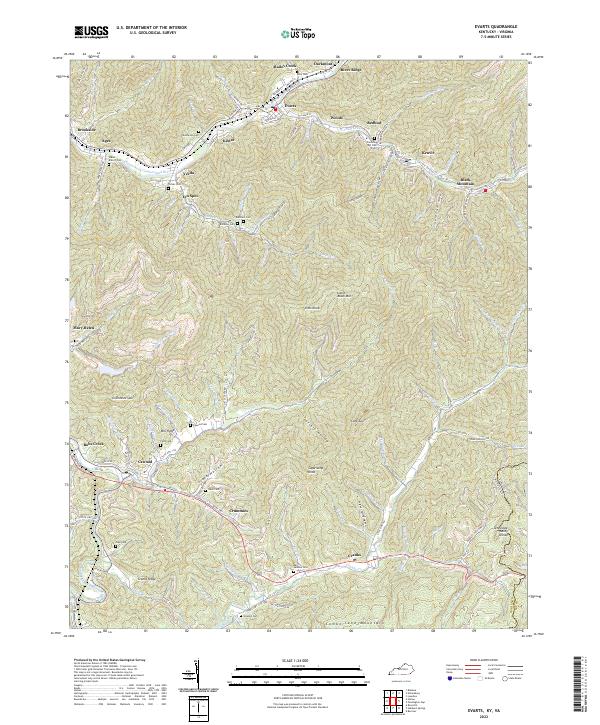
Evarts sits at the confluence of several mountain branches, serving as a focal point for the coal-mining communities along the Clover Fork Cumberland River. This 2022 survey details the dense network of family-named cemeteries and small settlements that line the hollows, including Ages, Kenvir, and Cawood. The terrain is defined by the steep rises of Cumberland Mountain to the south and Black Mountain to the northeast, creating a landscape where development is strictly tied to the valley floors. Genealogists will find a high density of burial sites such as Gabes Branch Cem, Rainbow Cem, and Jackson Cem tucked into the hillsides. The map captures the enduring legacy of the regional timber and mining era through features like the Rail Ln and the proximity to the Kentucky-Virginia state line, reflecting the isolation and connection of these Appalachian mountain towns.
Find a feature on this map
130 named features on this map. Tap any name to fly to it.
Don’t see what you’re looking for? This feature index may not catch every label — zoom into the map to look around manually.
Map Details
Editions of this 2022 Evarts Map
This is the sole edition of this map. No revisions or reprints were ever made.
Historical Maps of Verda Through Time
4 maps found