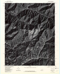
1976 Map of Evarts
USGS Topo · Published 1981About this map
Evarts and the surrounding coal-country settlements of Harlan County appear in sharp detail through this mid-1970s orthophoto. The settlement pattern follows the narrow valley floors, with Yocum and Kenvir lining the path of the Clover Fork Cumberland River. This aerial perspective highlights the dramatic relief of the Cumberland Mountains, where industrial activity and access roads cut distinct patterns into the timbered slopes. To the south, communities such as Cawood and Crummies are situated near the headwaters of Crummies Creek. Further south, the rural character of the region is evident near Cranks, where the landscape is dominated by the winding course of Cranks Creek. The imagery captures the critical relationship between the steep terrain and the concentrated valley developments that defined this Appalachian region during the late twentieth century.
Find a feature on this map
11 named features on this map. Tap any name to fly to it.
Don’t see what you’re looking for? This feature index may not catch every label — zoom into the map to look around manually.
Map Details
Editions of this 1976 Evarts Map
This is the sole edition of this map. No revisions or reprints were ever made.
Other maps of this area

1887 · Jonesville
USGS Topo · 1:125,000

1891 · Jonesville
USGS Topo · 1:125,000

1903 · Harlan
USGS Topo · 1:48,000

1916 · Harlan
USGS Topo · 1:48,000

1916 · Nolansburg
USGS Topo · 1:48,000

1919 · Nolansburg
USGS Topo · 1:62,500

1919 · Harlan
USGS Topo · 1:62,500

1932 · Hagan
USGS Topo · 1:62,500

1935 · Hubbard Springs
USGS Topo · 1:24,000
1935 · Evarts
USGS Topo · 1:24,000