Loading...
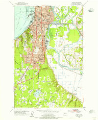
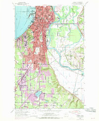
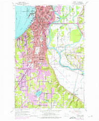
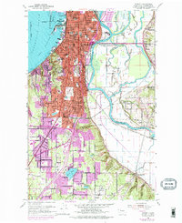
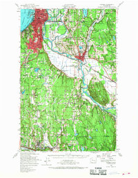
Loading map...1953 Map of Everett
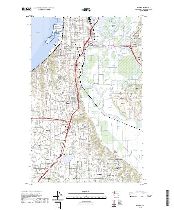
USGS Topo · Published 1955About this map
The Snohomish River delta defines the landscape east of Everett, where the waterway fractures into Union Slough, Steamboat Slough, and Ebey Slough. This mid-century survey reveals the city's complex industrial and social footprint, from the Naval Res on Port Gardner to the numerous schoolhouses serving growing neighborhoods like Pinehurst and Lowell. Evidence of the region's timber and transport economy is visible in the Sawmill and the rail lines of the Northern Pacific and Chicago Milwaukee St Paul and Pacific.
Find a feature on this map
98 named features on this map. Tap any name to fly to it.
Don’t see what you’re looking for? This feature index may not catch every label — zoom into the map to look around manually.
Map Details
Date Portrayed1953
Date Published1955
PublisherU.S. Geological Survey
Map TypeTopographic
Scale1:24000
Physical Dimensions22 x 27 inches
Editions of this 1953 Everett Map
4 editions found
Historical Maps of Holly Through Time
4 maps found

Featured Locations
Source Details
SourceU.S. Geological Survey
CopyrightPublic Domain