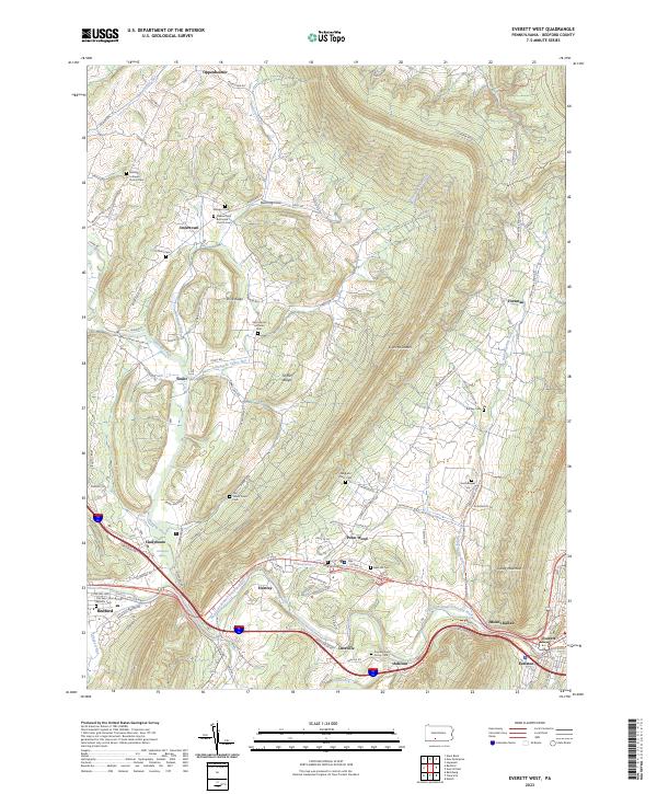
2023 Map of Everett West
USGS Topo · Published 2023About this map
Evitts Mountain and Tussey Mountain define the high-relief landscape of this Bedford County region, where the Raystown Branch Juniata River carves a path through the southern valley. The settlement pattern follows the lower elevations and watercourses, with concentrations at Everett and Chalybeate, the latter known for its historical Chalybeate Spring. This map is particularly valuable for genealogical research, documenting numerous family and church burial grounds such as the Reighard Farm Cem, Hershberger Cem, and the Smouse Farm Family Cem. Rural life is anchored by traditional landmarks like the Messiah Lutheran Church and the Albright Church, while smaller hamlets like Imlertown and Lutzville occupy the gaps between the ridges. The complex drainage network of Dunning Creek and Snake Spring Valley Run illustrates the hydraulic geography that shaped the area's development.
Find a feature on this map
105 named features on this map. Tap any name to fly to it.
Don’t see what you’re looking for? This feature index may not catch every label — zoom into the map to look around manually.
Map Details
Editions of this 2023 Everett West Map
This is the sole edition of this map. No revisions or reprints were ever made.
Other maps of this area

1900 · Everett
USGS Topo · 1:62,500

1902 · Everett
USGS Topo · 1:62,500

1908 · Bedford
USGS Topo · 1:62,500

1910 · Bedford
USGS Topo · 1:62,500

1927 · Clearville
USGS Topo · 1:48,000

1927 · Hyndman
USGS Topo · 1:62,500

1931 · Clearville
USGS Topo · 1:62,500

1931 · Hyndman
USGS Topo · 1:62,500

1944 · Hyndman
USGS Topo · 1:62,500

1944 · Clearville
USGS Topo · 1:62,500