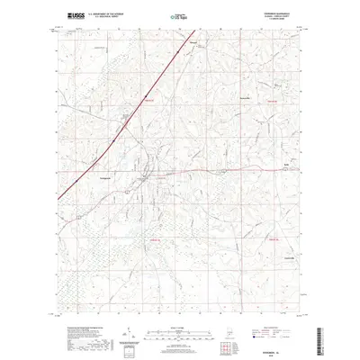
2020 Map of Evergreen
USGS Topo · Published 2020About this map
Evergreen serves as the regional hub for this portion of Conecuh County, anchored by institutions like Reid State Technical College and the Conecuh County Government Center. The landscape is defined by the winding course of Murder Cr and several smaller tributaries such as Cane Cr and Sandy Cr that traverse the rolling terrain of southern Alabama. Smaller surrounding settlements, including Owassa to the north and Rabb to the east, are connected by a network of county roads like Co HWY 29 and Co HWY 22.
Find a feature on this map
87 named features on this map. Tap any name to fly to it.
Don’t see what you’re looking for? This feature index may not catch every label — zoom into the map to look around manually.
Map Details
Editions of this 2020 Evergreen Map
This is the sole edition of this map. No revisions or reprints were ever made.
Other maps of this area

1953 · Andalusia
USGS Topo · 1:250,000

1957 · Andalusia
USGS Topo · 1:250,000

1971 · Lyeffion
USGS Topo · 1:24,000

1971 · Castleberry
USGS Topo · 1:24,000

1971 · Belleville
USGS Topo · 1:24,000

1971 · Garland
USGS Topo · 1:24,000

1971 · China
USGS Topo · 1:24,000

1982 · Evergreen
USGS Topo · 1:24,000

1982 · Nymph
USGS Topo · 1:24,000

1982 · Old Town
USGS Topo · 1:24,000