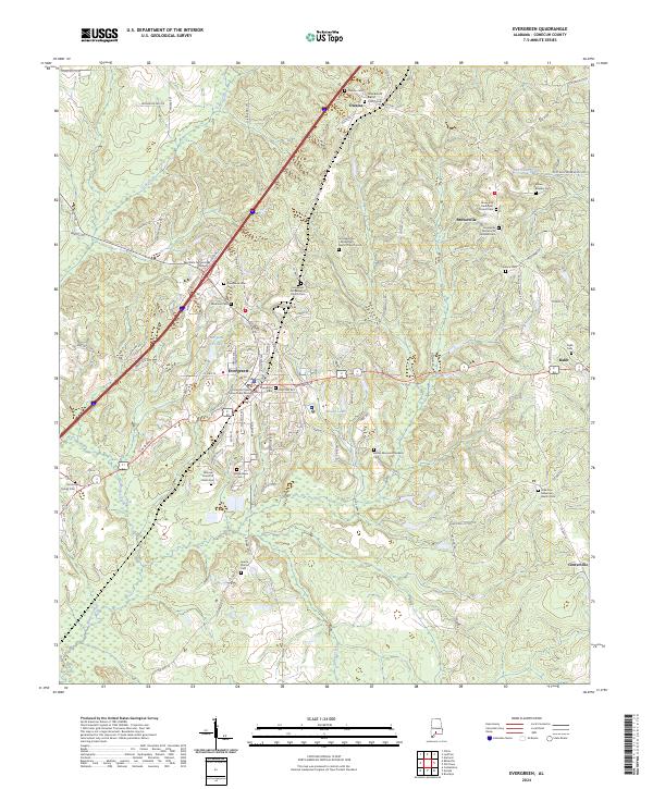
2024 Map of Evergreen
USGS Topo · Published 2024About this map
Evergreen serves as the focal point of this South Alabama survey, situated where the primary transit corridors intersect the landscape of Conecuh County. The town's civic character is anchored by the Conecuh County Government Center and educational institutions like Reid State Technical College. The map reveals a high concentration of small, family-named and denominational burial grounds, such as Brown Beasley Cem and the Olive Branch Baptist Church Cem near Owassa, providing significant data points for genealogical research. The surrounding terrain is defined by a network of creeks and small water bodies, including Murder Creek and Moody Lake, which shape the rural settlements of Brownville and Centerville. This modern record documents the contemporary road network and land divisions while preserving the locations of numerous historic cemeteries and churches throughout the county.
Find a feature on this map
97 named features on this map. Tap any name to fly to it.
Don’t see what you’re looking for? This feature index may not catch every label — zoom into the map to look around manually.
Map Details
Editions of this 2024 Evergreen Map
This is the sole edition of this map. No revisions or reprints were ever made.
Other maps of this area

1953 · Andalusia
USGS Topo · 1:250,000

1957 · Andalusia
USGS Topo · 1:250,000

1971 · Lyeffion
USGS Topo · 1:24,000

1971 · Castleberry
USGS Topo · 1:24,000

1971 · Belleville
USGS Topo · 1:24,000

1971 · Garland
USGS Topo · 1:24,000

1971 · China
USGS Topo · 1:24,000

1982 · Evergreen
USGS Topo · 1:24,000

1982 · Nymph
USGS Topo · 1:24,000

1982 · Old Town
USGS Topo · 1:24,000