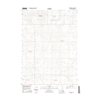
2015 Map of Evergreen NE
USGS Topo · Published 2015About this map
Badlands National Park dominates the northern landscape of this region, where the terrain breaks into the distinct erosional formations of the White River Badlands. The southern portion of the map transitions into the open plateau of the Pine Ridge Reservation, marked by a sparse network of roads and essential community landmarks. Local history is anchored at the Saint Luke Cem in the southwest corner, situated along a lonely stretch of Fire Trl. The hydrology of the area is defined by the ephemeral winding of Palmer Cr and Mousseaux Cr, which carve shallow drainages through the high plains. This map illustrates the intersection of federal protected lands and tribal infrastructure, connected primarily by Bia-25, a Bureau of Indian Affairs route that serves as the primary corridor for this rural part of the state.
Find a feature on this map
11 named features on this map. Tap any name to fly to it.
Don’t see what you’re looking for? This feature index may not catch every label — zoom into the map to look around manually.
Map Details
Editions of this 2015 Evergreen NE Map
This is the sole edition of this map. No revisions or reprints were ever made.
Other maps of this area

1950 · Conata SW
USGS Topo · 1:24,000

1950 · Imlay SW
USGS Topo · 1:24,000

1950 · Imlay SE
USGS Topo · 1:24,000

1951 · Sharps Corner
USGS Topo · 1:24,000

1955 · Hot Springs
USGS Topo · 1:250,000

1981 · Wall
USGS Topo · 1:100,000

1981 · Yellow Bear Camp
USGS Topo · 1:25,000

1981 · Kyle
USGS Topo · 1:25,000

1981 · Evergreen
USGS Topo · 1:25,000

1981 · Evergreen NE
USGS Topo · 1:24,000