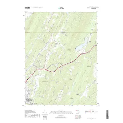
2019 Map of Evitts Creek
USGS Topo · Published 2019About this map
Cumberland sits at the base of the Appalachian ridges, where the Chesapeake and Ohio Canal National Historical Park preserves the legacy of the Potomac river trade. This landscape is defined by its deep vertical relief, with Shriver Ridge, Pine Ridge, and Warrior Mountain forming parallel barriers that shaped early settlement patterns. Along the valley floors, the Evitts Creek Aqueduct stands as a notable engineering landmark, while clusters of family and community history are preserved in the Robinette Family Cemetery and Zion Park Cemetery. The transition from the urban streets of South Cumberland to the high elevations of Breakneck Hill illustrates the topographic divide that characterizes this part of the Maryland and Pennsylvania borderlands. Rural communities like Dickens, Twiggtown, and Wolfe Mill are connected by historical routes like the National Pike, marking the westward expansion through the Rocky Gap.
Find a feature on this map
117 named features on this map. Tap any name to fly to it.
Don’t see what you’re looking for? This feature index may not catch every label — zoom into the map to look around manually.
Map Details
Editions of this 2019 Evitts Creek Map
This is the sole edition of this map. No revisions or reprints were ever made.
Other maps of this area

1898 · Frostburg
USGS Topo · 1:62,500

1899 · Flintstone
USGS Topo · 1:62,500

1900 · Flintstone
USGS Topo · 1:62,500

1901 · Frostburg
USGS Topo · 1:62,500

1908 · Frostburg
USGS Topo · 1:62,500

1923 · Berlin
USGS Topo · 1:48,000

1927 · Hyndman
USGS Topo · 1:62,500

1929 · Berlin
USGS Topo · 1:62,500

1931 · Hyndman
USGS Topo · 1:62,500

1944 · Hyndman
USGS Topo · 1:62,500