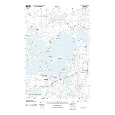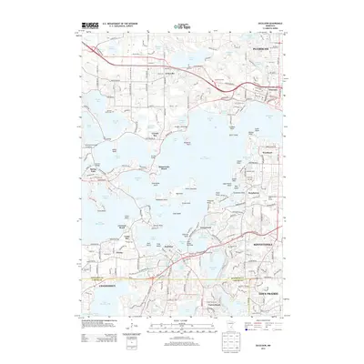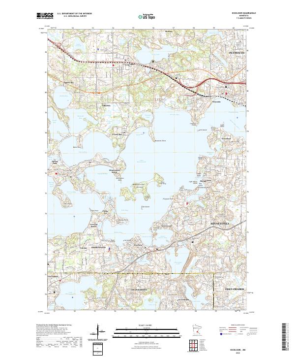
2022 Map of Excelsior
USGS Topo · Published 2022About this map
The intricate shoreline of Lake Minnetonka dominates this landscape, defining the boundaries of lakeside communities like Wayzata, Deephaven, and Minnetonka Beach. The map details a complex arrangement of peninsulas and islands, including Mahpiyata Island Big Island, Point Charming, and Bracketts Point, illustrating how the water dictates the settlement patterns of the region. To the north, the Luce Line State Trail follows an old railroad alignment through Orono and Long Lake, providing a historical throughline across the terrain.
Find a feature on this map
108 named features on this map. Tap any name to fly to it.
Don’t see what you’re looking for? This feature index may not catch every label — zoom into the map to look around manually.
Map Details
Editions of this 2022 Excelsior Map
This is the sole edition of this map. No revisions or reprints were ever made.
Historical Maps of Plymouth Through Time
7 maps found