1985 Map of Excelsior Mts
USGS Topo · Published 1985About this map
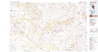
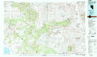
Mina and Sodaville sit at the intersection of desert industry and transportation in this mid-1980s mid-scale survey. The landscape is defined by the high desert basins of Soda Spring Valley and Huntoon Valley, flanked by the massive Wassuk Range and Excelsior Mountains. The region's long-standing mining economy is evidenced by numerous operations such as the Borealis Mine, Silver Dyke Mine, and Pamlico Mines. The map also captures the extensive footprint of the Hawthorne Ammunition Depot and the route of the Southern Pacific railroad.
Find a feature on this map
46 named features on this map. Tap any name to fly to it.
Don’t see what you’re looking for? This feature index may not catch every label — zoom into the map to look around manually.
Map Details
Editions of this 1985 Excelsior Mts Map
2 editions found
Other maps of this area

1891 · Wellington
USGS Topo · 1:125,000

1893 · Wellington
USGS Topo · 1:125,000

1898 · Silver Peak
USGS Topo · 1:125,000

1900 · Silver Peak
USGS Topo · 1:125,000

1901 · Mt. Lyell
USGS Topo · 1:125,000

1907 · Tonopah
USGS Topo · 1:250,000

1908 · Lida
USGS Topo · 1:250,000

1908 · Tonopah
USGS Topo · 1:250,000

1909 · Hawthorne
USGS Topo · 1:250,000

1909 · Bridgeport
USGS Topo · 1:125,000