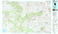
1985 Map of Excelsior Mts
USGS Topo · Published 1985About this map
Excelsior Mountains and the arid expanse of the Great Basin define this mid-1980s terrain along the Nevada and California border. The map reveals a landscape heavily shaped by mineral extraction and military presence, anchored by the sprawling Hawthorne Ammunition Depot in the north and the deep-rooted mining history at the Borealis Mine and Silver Dyke Mine. Transport corridors follow the paths of the Southern Pacific railroad and historic routes like the Bodie-Aurora Road, which connected once-booming mining camps across the state line.
Find a feature on this map
54 named features on this map. Tap any name to fly to it.
Don’t see what you’re looking for? This feature index may not catch every label — zoom into the map to look around manually.
Map Details
Editions of this 1985 Excelsior Mts Map
2 editions found
Other maps of this area

1891 · Wellington
USGS Topo · 1:125,000

1893 · Wellington
USGS Topo · 1:125,000

1898 · Silver Peak
USGS Topo · 1:125,000

1900 · Silver Peak
USGS Topo · 1:125,000

1901 · Mt. Lyell
USGS Topo · 1:125,000

1907 · Tonopah
USGS Topo · 1:250,000

1908 · Lida
USGS Topo · 1:250,000

1908 · Tonopah
USGS Topo · 1:250,000

1909 · Hawthorne
USGS Topo · 1:250,000

1909 · Bridgeport
USGS Topo · 1:125,000